
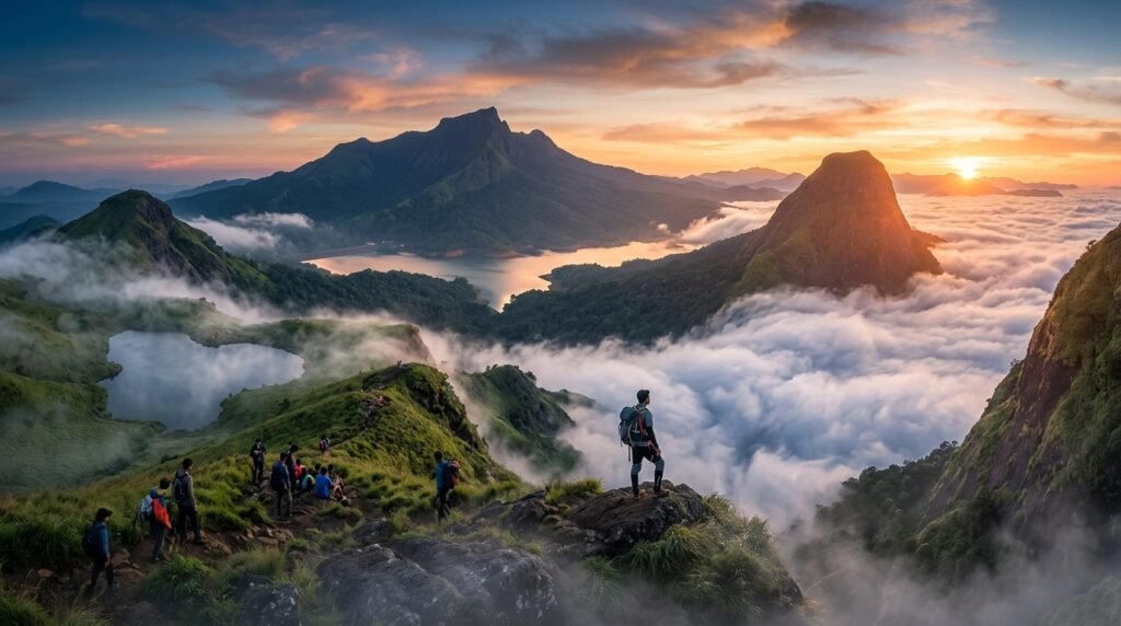
Wayanad is renowned for its emerald valleys and misty vistas, but nothing compares to experiencing its landscapes from above the clouds. Rising high above the Western Ghats, the trio of Chembra Peak, Banasura Hills, and Kurumbalakotta offers three distinct high-altitude adventures:
- A legendary heart-shaped lake surrounded by mist.
- A challenging trek through dense rainforests and rolling grasslands.
- A magical morning sunrise over an endless sea of clouds.
Whether you are seeking a relaxed morning hike or an intense mountain challenge, here is your complete 360° guide to trekking Wayanad’s ultimate sky-high trails.
Chembra Peak: The Heart of Wayanad
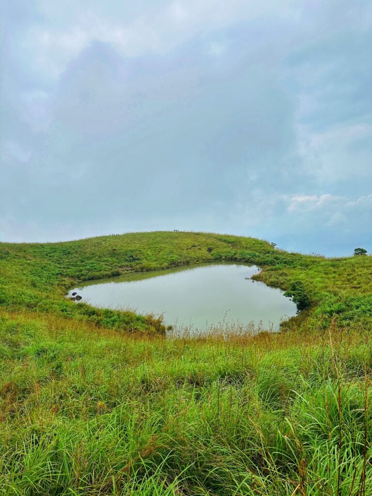
Standing as the highest peak in the district at 2,100 meters above sea level, Chembra Peak is famous for its iconic, naturally formed heart-shaped lake (Hridaya Saras), located midway to the summit.
- Difficulty Level: Moderate
- Trek Distance: ~4 km (round trip to the lake)
- Time Required: 3 to 4 hours
- Best Time for Views: Early morning (8:00 AM – 11:00 AM)
What to Expect on the Trail
The trail begins amidst sprawling tea plantations before transitioning into steep, grassy slopes. As you gain altitude, cool mountain winds replace the lowland humidity. After about 1.5 to 2 hours of steady uphill hiking, the terrain flattens out at the famous heart-shaped lake. Resting here while wrapped in swirling clouds is one of Wayanad’s quintessential experiences.
Important Travel Note: To protect the delicate eco-system, trekking all the way to the top summit is restricted by the Forest Department. Treks are permitted only up to the heart-shaped lake.
Essential Trekking Information
- Permits & Timings: Passes are issued on a first-come, first-served basis at the VSS office at the base. Trekking opens at 7:00 AM and passes often sell out by late morning—arrive by 6:30 AM on weekends.
- Guide Requirement: A local forest department guide is mandatory and included with your permit fee.
Banasura Hills: The Ultimate End-to-End Challenge
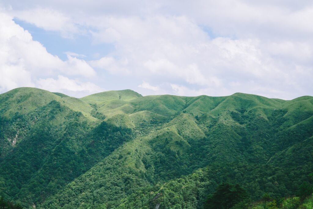
If Chembra Peak offers iconic scenery, Banasura Hills delivers raw adventure. As the second-highest peak in Wayanad (2,073 meters), this trek takes you through dense shola forests, steep rocky scrambles, and open mountain ridges overlooking the Banasura Sagar Dam reservoir.
- Difficulty Level: Strenuous / Challenging
- Trek Distance: ~18 km (round trip)
- Time Required: 7 to 9 hours
- Best Time for Views: October to February (clear skies & cool winds)
What to Expect on the Trail
This is a full-day, endurance-testing trek. The first stretch winds through dark shola rainforests where streams cut through the trail. Once clear of the tree line, you will tackle a series of rolling hills before reaching the final steep ascent to the peak. The summit awards you with an expansive 360-degree panorama of the reservoir and surrounding mountain ranges.
Essential Trekking Information
- Permits & Timings: Prior permission from the local Forest Department is required. Start your trek no later than 6:00 AM – 7:00 AM to ensure a safe descent before daylight fades.
- Preparation: Carry at least 2.5–3 liters of water, high-energy snacks, and wear sturdy trekking shoes with strong grip.
Kurumbalakotta: The Sea of Clouds
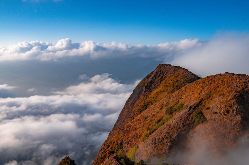
Unlike Chembra and Banasura, Kurumbalakotta is not a long endurance trek. It is a monolith hill famous for one breathtaking phenomenon: a panoramic sunrise over a dense bed of morning fog, locally celebrated as the “Sea of Clouds.”
- Difficulty Level: Easy to Moderate
- Trek Distance: ~1.5 km (one way)
- Time Required: 45 minutes to 1 hour
- Best Time for Views: 5:30 AM – 6:30 AM
What to Expect on the Trail
The hike follows a short, rocky path that climbs quickly. Starting your hike around 5:00 AM in total darkness (bring a headlamp or flashlight) allows you to reach the summit plateau just as the horizon begins to turn orange. As dawn breaks, the valleys below are completely submerged in a thick blanket of white mist, leaving only the surrounding hilltops poking through like islands in an ocean.
Essential Trekking Information
- Permits & Timings: Open access without strict permit limits, though local parking fees apply at the base.
- Pro-Tip: Check the local weather forecast before going. Clear, cool nights following a humid day usually create the best cloud cover in the morning.